
This project is ongoing! Check back often to see updates to the WMTA 👀
To see the previous version (2015) of this project, click here
In late 2015, I was finishing up my master’s degree at the University of Westminster in London. I had the opportunity to deliver my thesis—“The River,” a design for a fictional metro system in the city of Grand Rapids, Michigan. It was my own careful examination of branding and wayfinding design, as well as an earnest expression of love for a city I had come to call home. Ten years on, I’ve been genuinely excited to revisit the project with a fresh set of eyes and a bit more experience under my belt.
The map
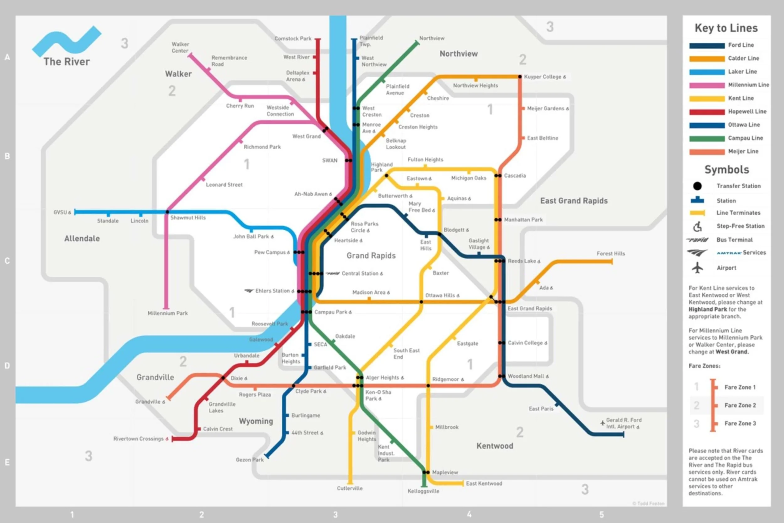
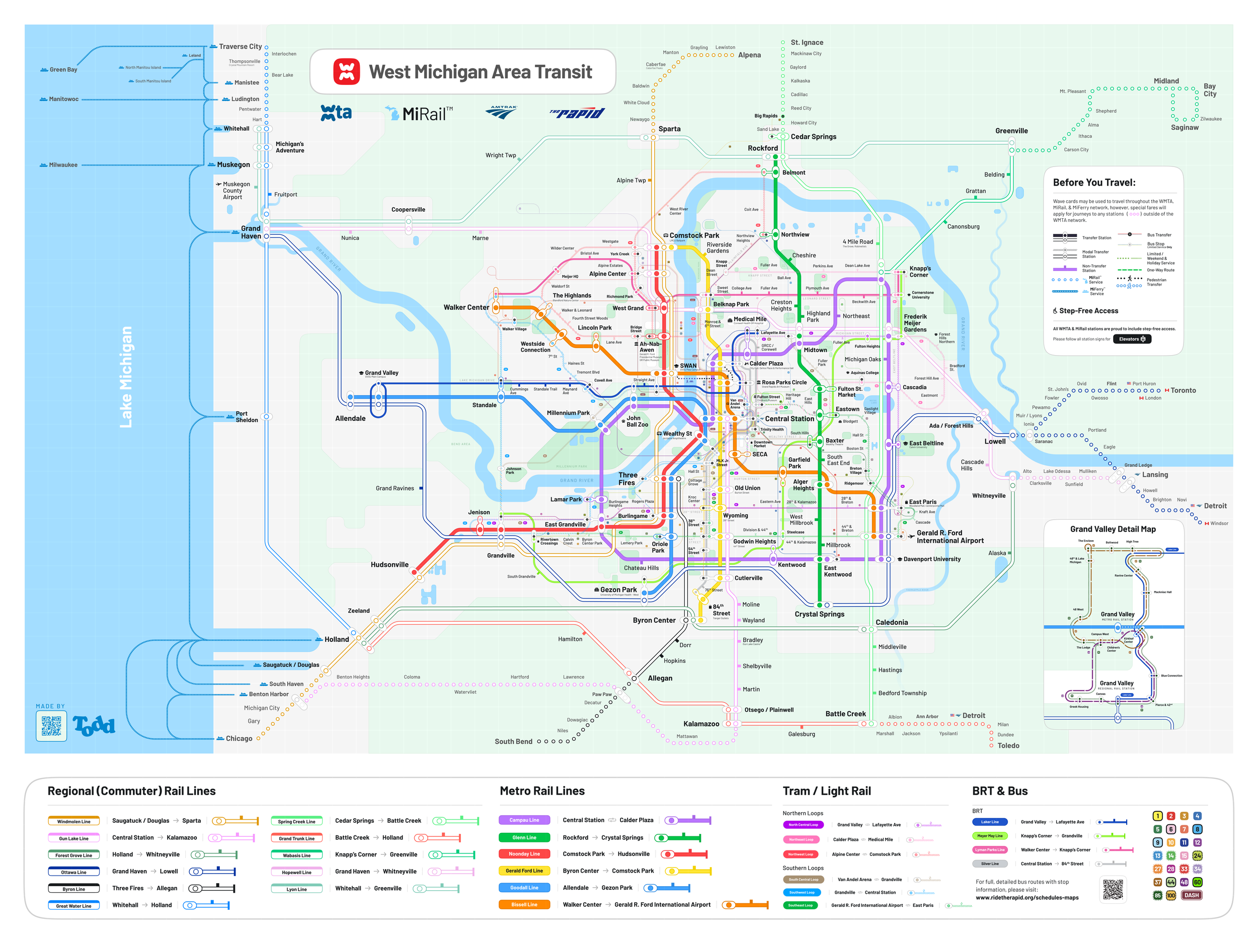
The first major piece of this project refresh is also its central piece—the system map. From it flows the rest of the system’s design language, so it’s the best representation of it. All maps tell stories, and this one narrates the vision of a metropolitan West Michigan with a radically reimagined transit network. A story in which West Michigan is closely connected to itself and to neighboring regions by ferry, bus, and rail.

Like the vast majority of metropolitan areas in North America, West Michigan’s modern development has been centered around the car. But, like many of those same areas, it wasn’t always this way. This project explores an alternative timeline where many of these historical systems were perhaps kept in place and/or improved over time, turning West Michigan into an even more modern, accessible, and convenient place to live & work.
Want a print? Let me know!
I’m exploring making a small run of map prints, but only if there’s interest! Give me a shout.